|
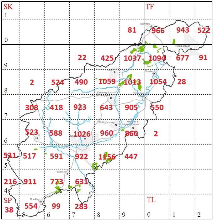
This map shows the total number of species (micro-moths & macro-moths) recorded in each 10Km grid square after the incorporation of all records received up to the end of 2023. This clearly shows that the West of the county remains less well recorded than central and East, but far less so than previously. This reflects some recent recorders to send in data from the Brackley and Towcester areas. This map also reflects the increase in recording of micro-moth species, with no less than fourteen 10Km squares containing more than 900 species. The high species count in SP85 reflects the work done over the years in Yardley Chase over the years, with particular focus on micros, leaf-mines, etc. 2nd best is TL09, which includes some of the Rockingham Forest woodland (Glapthorn Cow Pasture, Ring Haw/Sulehay & a portion of Bedford Purlieus). SP88 remains our 3rd best grid, containing Weekley Hall Woods, which have been heavily worked in previous years. SP88 also contains some well-worked gardens too!! |
 |